


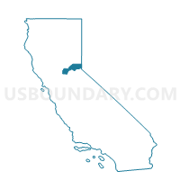
Voting District 30095, Placer County, California
About
Outline

Summary
| Unique Area Identifier | 536892 |
| Name | Voting District 30095 |
| County | Placer County |
| State | California |
| Area (square miles) | 1.82 |
| Land Area (square miles) | 1.82 |
| Water Area (square miles) | 0.00 |
| % of Land Area | 99.76 |
| % of Water Area | 0.24 |
| Latitude of the Internal Point | 38.86641990 |
| Longtitude of the Internal Point | -121.12659300 |
Maps


Graphs
Select a template below for downloading or customizing gragh for Voting District 30095, Placer County, California


Neighbors
Neighoring Voting District (by Name) Neighboring Voting District on the Map
- Voting District 30080, Placer County, CA
- Voting District 30110, Placer County, CA
- Voting District 30185, Placer County, CA
- Voting District 30190, Placer County, CA
- Voting District 30195, Placer County, CA
- Voting District 30415, Placer County, CA
- Voting District 30420, Placer County, CA
- Voting District 30505, Placer County, CA
- Voting District 30615, Placer County, CA
- Voting District 30645, Placer County, CA
Top 10 Neighboring County Subdivision (by Population) Neighboring County Subdivision on the Map
Top 10 Neighboring Place (by Population) Neighboring Place on the Map
Top 10 Neighboring Elementary School District (by Population) Neighboring Elementary School District on the Map
- Auburn Union Elementary School District, CA (33,064)
- Loomis Union Elementary School District, CA (19,259)
- Newcastle Elementary School District, CA (2,496)
Top 10 Neighboring Secondary School District (by Population) Neighboring Secondary School District on the Map
Top 10 Neighboring State Legislative District Lower Chamber (by Population) Neighboring State Legislative District Lower Chamber on the Map
Top 10 Neighboring State Legislative District Upper Chamber (by Population) Neighboring State Legislative District Upper Chamber on the Map
Top 10 Neighboring 111th Congressional District (by Population) Neighboring 111th Congressional District on the Map
Top 10 Neighboring Census Tract (by Population) Neighboring Census Tract on the Map
- Census Tract 206.02, Placer County, CA (6,970)
- Census Tract 205.02, Placer County, CA (4,103)
- Census Tract 205.01, Placer County, CA (2,879)